 I wanted to be able to extract the drawing from this photograph. Using PTLens, I could either make the top and bottom edges vertical or the left and right edges. But not both pairs at the same time. The green rectangle on the photograph has a 3:4 ratio, which is my estimate of the ratio of the drawing paper. This is the best that PTLens could do.
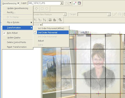
Then I decided to pull out the big guns. Using ArcMap and the Georeferencing toolbar I realized that I could come much closer to what I wanted. I added the photograph into ArcMap along with a grid graphic. The first point I added was to connect the upper left of the drawing with a point on the grid. Here I'm adding the upper right corner.

Once I had 6 control points I was able to create a second order polynomial transformation.

And here is the final result. Much better fit !

